How to create Terrain Maps in Blender
POC activity
- Select any portion of a Google Map. Generate a texture using Google satellite imagery
- Generate a height map using elevation data provided online by NASA
- Generate 3d Terrain Mesh inside Blender.
- Use these meshes as background in our scene.
Picture of Karakoram Range Terrain Map
Preliminary Steps
- Download Blender GIS add and install in Edit-Preferences-Addon
- https://github.com/domlysz/BlenderGIS
- Install GDAL (Geospatial Data Abstraction Library) using brew or pip
- Steps -> https://gist.github.com/kelvinn/f14f0fc24445a7994368f984c3e37724
- Enable Node Wrangler Add-On
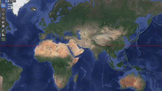
- Load Google BaseMap from GIS Menu


Comments
Post a Comment